

REST API, Service version 1.0.0
Near POI#
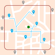
Find POI around a coordinate, limited by distance of travel from coordinate to POI.
Summary#
- Request
- Parameters
- Response
- Details of fields
- Response samples
Request#
The request must be sent with the HTTP method POST and the HTTP header Content-Type set to application/json.
Sample:
URI: /bgis/service/nearpoi/1.0
POST data:
{
 "coordinate": {
  "longitude": 2.40552,
  "latitude": 48.85342
 },
 "distance": 70,
 "transportType": "PEDESTRIAN",
 "orderBy": "DISTANCE_ASC"
}Parameters#
coordinateCoordinateSatrequiredCoordinate of center of research, will be used with
distanceparameter.CoordinateSat fields
lonnumber (double)requiredLongitude in degrees decimal (WGS84).
Also accepted as
longitude.latnumber (double)requiredLatitude in degrees decimal (WGS84).
Also accepted as
latitude.headingnumber (double)Heading in degrees.
speednumber (float)Speed in km/h.
timeinteger (int64)GPS time in milliseconds (EPOCH).
satinteger (int32)Number of GPS satellites available.
distanceinteger (int64)requiredLimit of research in meters.
geoserverstringGeoserver name.
swidxinteger (int32)deprecatedSwitch index.
transportTypeenumDefine the transportation mode: Car, pedestrian, truck, etc. By default PEDESTRIAN.
9 accepted values
PEDESTRIANPedestrian. BICYCLEBicycle. MOTORCYCLEMotorcycle. CARPassenger car. TAXITaxi. PUBLIC_BUSPublic bus. EMERGENCYEmergency vehicle. DELIVERY_TRUCKDelivery truck. Deprecated, use TRUCKinstead.TRUCKTruck. orderByenumSort the result by distance or duration in either ascending or descending. Disable by default.
4 accepted values
DISTANCE_ASCSort by distance in either ascending. DISTANCE_DESCSort by distance in either descending. DURATION_ASCSort by duration in either ascending. DURATION_DESCSort by duration in either descending. plbooleanEnable the output polyline geometry of route. Set to true to enable otherwise false. Disable by default.
eplbooleanEnable the output encoded polyline geometry of route with Google Algorithm. Set to true to enable otherwise false. Disable by default.
serviceCategoriesstring[]Service categories. POI Class ID (numeric value defining the type of service, see the
Class ID listin Glossary menu).
Response#
Return the list of POI around the input coordinate.
Details of fields#
poisNearPoint[]Points of interests.
NearPoint fields
coordinateCoordinateGeographical coordinate of POI.
distanceinteger (int64)Distance of travel in meters between the input coordinate and POI.
durationinteger (int64)Duration of travel in seconds between the input coordinate and POI.
typestringType of POI.
namestringName of POI.
telephonestringPhone number of POI.
commentstringComment.
polylineCoordinateFullName[]Polyline geometry of route between start coordinate and the POI.
CoordinateFullName fields
longitudenumber (double)requiredLongitude in degrees decimal (WGS84) (double).
latitudenumber (double)requiredLatitude in degrees decimal (WGS84) (double).
altitudenumber (double)Altitude in meters.
encodedPolylinestringPolyline geometry of route between start coordinate and the POI. It is a composed of coordinates list and encoded with Google Algorithm.
Response samples#
JSON Sample:
{
	"pois": [{
			"coordinate": {
				"longitude": 2.40595,
				"latitude": 48.85328
			},
			"distance": 54,
			"duration": 61,
			"type": "SHOP",
			"name": "JEAN CARIL",
			"telephone": "+(33)-1-43675352"
		}, {
			"coordinate": {
				"longitude": 2.40577,
				"latitude": 48.85382
			},
			"distance": 64,
			"duration": 67,
			"type": "RESTAURANT",
			"name": "JARDIN D'OR",
			"telephone": "+(33)-1-44649320"
		}, {
			"coordinate": {
				"longitude": 2.40598,
				"latitude": 48.85316
			},
			"distance": 68,
			"duration": 66,
			"type": "RESTAURANT",
			"name": "MAXILIFE",
			"telephone": "+(33)-1-43792928"
		}, {
			"coordinate": {
				"longitude": 2.40575,
				"latitude": 48.85386
			},
			"distance": 68,
			"duration": 71,
			"type": "RESTAURANT",
			"name": "LE MONTANA",
			"telephone": "+(33)-1-43483873"
		}
	]
}