Enterprise Mapping & Geolocation Platform
Precise geolocation • Flexible integration • Reliable routing
BeMap is a mapping server solution that provides advanced geolocation functions for transport operators.
Available as a suite of web services that can be seamlessly integrated into back-end IT systems and mobile or web applications.
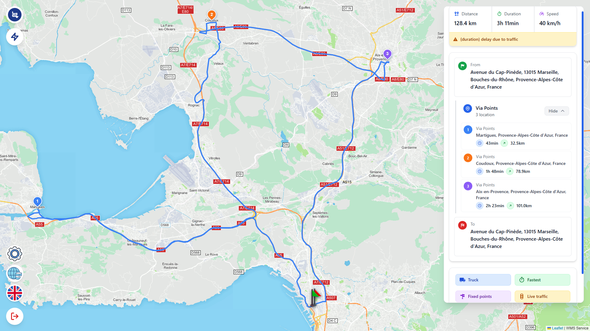
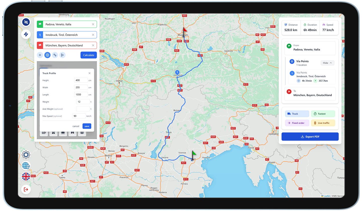
Accessed via a set of web services, BeMap offers a suite of functions for planning and analysing routes, calculating vehicle journeys (for cars/HGVs), tracing back over completed journeys and calculating transportation costs.
Uses include:
- Location and monitoring of vehicles
- TMS system development
- HGV route calculation
- Delivery route identification and optimisation
Available Features
Available via web services based on JSON-RPC or SOAP

Map Display

Geocoding & Reverse Geocoding

Route Calculation

Traffic (Real-time & Statistical)

Delivery Route Creation & Scheduling

Route retrace

Geo-fencing and corridor fencing
Industries served
Telematics Operators
- Fleet management (HGVs, light commercial, and energy-efficient vehicles)
- Remote personnel safety
- Stolen vehicle recovery (SVR)
- Usage-based insurance (Pay As You Drive)
Software Providers and Integrators
- TMS and route finding
- Route optimization
- Geo-marketing
- Waste collection and route management
Trusted by